Sunday, July 5, 2015

View

13.4 miles

Battell Shelter Trail to Skyline Lodge

Local scenery.
Signs are a welcome landmark, as oftentimes,
what's on the  map is not marked on the trail!
The trail from Battell Shelter to Skyline Lodge crosses what is known as the Breadloaf Wilderness. It's always interesting, while backpacking, to distract the mind and ponder just how certain places get their name. All kinds of scenarios come to mind. Does it look like a breadloaf??? Did ancient inhabitants have some ritual involving it??? Were more recent settlers sustained in heavy winters by bread loaves they made??? Is there a peculiar smell, like a bread loaf??? Is the ground spongy, like.... a bread loaf. Heck, I don't know and google didn't turn up anything easily! But here it is and a sign to prove it!

This morning I said goodbye to Gabriel. On his tight deadline he's gonna have to pull 20 mile days from here to the end if he wants to make it, which is not my plan. Sure was nice to have company while it lasted though. The trail has gotten easier but the blazing still sucks. Walked for almost an hour today with out seeing a blaze! I finally passed some day hikers who confirmed I was indeed still on the Long Trail (phew). Felt like I was being attacked by pine trees on and off today as they were growing into the trail at numerous points and you just had to push through.

View from Sunset Ledge, overlooks the Adirondaks
and Lake Champlain.
When I arrived at the Skyline Lodge I was greeted by a very enthusiastic little girl asking me my trail name (looking disappointed when I didn't have one) and introducing herself as Hummingbird and her dad as Goose. Humming bird is 10 and her and her dad are through hiking the long trail northbound. Also her pack weighs 15-20 lbs! Positive, Negative (a retired couple who had through hiked the AT when they were younger) and their dog were also at the shelter along with a few other people. They were all great company and Goose even shared some of the Long Trail IPA he hiked in, with me! All in all it was a great evening at a great shelter with some great people. It made me a little sad to be hiking in the wrong direction. Not too sad though because they still have all the hard stuff to look forward to.

At this point, the Green Mount Club Long Trail Map, which is folded into 7 sections, is flipped. Three down and 4 to go! The last few days have been fairly sunny. Yippee!


Saturday, July 4, 2015

Celebrate!

10.5 miles

Appalachian Gap and the Battell Trail
See the clouds rolling in!? Rain is a part of the scenery here.
Sky lift in summer. Who would guess this
is what's waiting to bloom under 2' of snow!
The  Green Mountains are most often known for the great skiing available in winter, even by those outside Vermont. The Long Trail, while popular in Vermont, has yet to catch up to them reputation wise. But the views Camille is seeing are beautiful, dramatic and in sharp contrast to what winter brings. 

View from Mt. Abraham (of course!)
Battell Trail climbs steadily to the top of Mount Abraham, one of Vermont’s five 4,000’ mountains. There are great panoramic views of the White Mountains, the 'Dacks and Killington Peak. Camille has backpacked in the 'Dacks, short for Adirondacks, and gets a good view of ground she has covered in this trip.

To give an idea of just how hard the LT (Long Trail) is, Camille shared a shelter with 3  'triple crowners'. A triple crowner is someone who has backpacked the AT (Appalachian Trail), the PCT (Pacific Crest Trail) AND the CDT (Continental Divide Trail). One commented that if they had known how hard the Long Trail was, they never would have done it.

If Camille had started where most backpackers who do
the Green Mountains do, this is the sign that would
have greeted her. At this point, the Appalachian
Trail meets up with the Long Trail.
I don't feel so bad saying there is not a bone in my body that would want to do it. The reality is, the LT, though shorter, takes a much larger toll on those who climb it because of it's steepness, rock slabs, ladders and rain. Add 35-40 lbs for the back pack, which is considered on the light side, and it's a real challenge.


As what sometimes happens, paths cross again! Camille shared a feast by backpacking standards when Gabriel arrived at the shelter with friends. They hiked in 2 miles with crusty bread, cheese, meats and fondue to celebrate progress, stories and adventures.
Appetizers! Cheese, meat and crusty bread!


Interior of Stark's Nest Shelter.

Friday, July 3, 2015

Hide Away Inn

5.5 miles

Molly Stark Balcony
Camille got an early start again today, about 6 am. 

Here's a view from Molly Stark Balcony. You can see Camel's Hump. It looks so far. Hard to believe that was yesterday!

Every 5 days or so it's good to get off the trail and catch up on necessities, like sleep, hot meal and laundry. Camille hiked from Cowles Cove, to where VT 17 hits the trail, and hitched a ride to the Hide Away Inn. People are very friendly to hikers in this part of the world. She was told by the innkeeper when she made contact with them a month or more ago to wait at the top of the hill and stick her thumb out. First vehicle to come her way gave her a ride down the mountain to the Inn. She shared it with a St. Bernard dog as well.  

The Hide Away Inn is a rustic place, nestled into the side of the road with trees and rocks, about 4 miles from the trail, and they do like hikers as guests. Camille arrived about 9:45 am, missing breakfast for the day, but they brought up a breakfast sandwich to her room AND did her laundry for her. How sweet is that?! She had a couple local beers in the evening that were pretty tasty, too. "I must be a light weight, after a few weeks on the trail!" says she.

Each shelter has a paper log for those who stay there and it's fun to log in and see if the names in the last shelter are familiar, or someone you crossed paths with comes by again. She ran into Gabriel at the Inn, from the hike down Mt. Mansfield and they shared a couple beers before he headed off to catch zzzz somewhere else. A monster blister is slowing him down, ouch! Here's some of the local color, too.

Breakfast this morning was french toast, eggs and bacon. Fuel to start the day.


Thursday, July 2, 2015

Camel's Hump

10 miles

Last night I shared Bamforth shelter with 2 north bounders and 3 section hikers.  Decided to try out some ear plugs, it was great! I'm annoyed my alarm didn't go off, though. I would have loved to have made it to the next shelter. (Wonder if schlogging 15 miles in rain has anything to do with it???)
See, I made it!

Today I went up and over Camel's Hump, the lowest point on this map to the highest. The top is basically a bald, above the tree line. Settled in at Cowles Cove lean-to.


View from the top of Camel's Hump, almost 360 degree view


View of Camel's Hump a couple miles before I summited it.

Where I've been!
Where I am going.


Wednesday, July 1, 2015

Grueling Day

15  Miles

Uhhhgg! What a day for mom to go home! It rained all day. Squelch! I didn't take any pictures today because it was raining. It rained all day and the reroute was not marked mileage wise so I was in a pretty bad mood all day. I crossed the Winooski River suspension bridge, did the road walk and am now on the third map.


Monday, June 29, 2015

Where ARE you?

A view of what's ahead from Mt. Mansfield....Camel's Hump,
the Adirondaks, and beyond.
Stairs in Green Mtn Inn. 
4.7 miles

I left Camille at the top of Mt Mansfield, to go to what was going to be a lonely last night at the Green Mountain Inn. The inn has got to be one of the most comfortable, historical places to stay in the area. It's old, well appointed and friendly to thru hikers. We learned after the fact, that if you are a member of the Green Mountain Club you get a substantial discount. Not a bad way to support the trail maintenance and get a respite from it! As it turned out, there is a toll road that comes down near Stowe, from the other side of Mansfield. Camille had gotten a ride down and to the inn before I got back. What a great surprise! We enjoyed a nice dinner at a mexican restaurant and the really fluffy beds, one more night. We headed back up the toll road in the morning and this is what we missed yesterday!


Today!
What a difference a day makes, yesterday....


Met thru hiker Gabriel and we hiked down the mountain together.

Sunday, June 28, 2015

Rain, Rain Rain, Rain, Rain, Rain is the New Normal

7.6 miles
   
Gathering water
It was really apparent that rain is an integral part of living in this part of Vermont. Although the locals are used to it, they did admit this is the most rain they have seen a quite a while. It was time to get back to the trail, or never finish it! We started up Mt Mansfield, where it crosses VT 108. While taking 2 days off to catch up on rest and evaluate every ounce being carried, what was necessary, what could be dispatched with and where to make adjustments to lighten her load, Camille decided to try another water purification system. The great thing about doing a trail like this is that in crossing paths with other thru hikers, it's easy to consider other ways of doing things that are tested and recommended. Instead of carrying 2-4 liters of water, which is close to 10 lbs, some backpackers opt for the Sawyer Squeeze and only carry about 1/2  a liter at a time. It's quicker, and can be done more often and is drinkable in minutes verses almost an hour with the Aqua Muir drops. It's only drawback is does not kill viruses which are not usually found in this part of the country. We stopped at Taft lLodge for a snack and to test out the new system. Worked great!
Attaching filter to top
Squeeze water thru filter
into a spare bottle

As was expected, the trail was wet, water running everywhere, mud and swamp patches to negotiate as best as possible. We were actually hiking up into the clouds
Transfer filter water to
water bladder. The bladder
goes in the bacpack and is
accessible thru a drinking
tube while hiking.
So much iridescence, it was like
walking over copper, gold and silver.
Taft Lodge is situated partially up Mt. Mansfield,
Vermont's tallest mountain.
Taft Lodge is off the ski trails and looks like it could
accommodate at least 20 overnight guests.


I could not keep the hood
back on my rain jacket, so
opted for, as Camille called
it, the "mouse" look, lol.
It's a beautiful and remote setting with reminders
everywhere of it's past transients.


We were told there are spectacular views from the top of Mansfield. The last 100 yards or so is a steep rock scramble. It was probably good we couldn't see much beyond that. The wind picked up, the clouds hung close. We had to settle for the medallion that marked we had made it.

Camille headed over and down the other side, while I made my way, a bit weepy, back down where we had come. My head told me she was prepared, technically skilled from her years of rock climbing, and has a great gut instinct, but still....... sniff.

I hiked down with 2 very nice young men, James and Scott. They had come up a spur trail, which was steeper and more rock slabs. I gave them a ride back to their car when we sloshed back down to the bottom.


Saturday, June 27, 2015

Zero Day

0 miles

What would you do after walking almost 70 miles up and down mountains, carrying close to 40 lbs on your back in 7 days?

Beer, burger and fries at The Blue Donkey in Stowe VT, of course!

We also did laundry, explored Stowe, alternated between hot tub, cold pool. Rested.

Friday, June 26, 2015

Bear Hollow to VT 108

10.8 miles

Top of White Face
This was a hard day. I was tired, terrain was very rough and my feet were still wet. They had been wet since Haystack a few days back. I stopped for a long rest on White Face Mountain and was bummed as I looked out over all the mountains I had to cross. I was going to meet Mom at VT 108 and we were going to head up Mansfield, so had been texting her with updates. My phone was a little over half charged, my battery block for recharging it was out. It took me a while to get going. Mom texted me around 12:30 to let me know she was on here way up to meet me. I made the Trail Magic raman on top of Madonna peak and it was so fricking good! It was a good 15 minute stop and cold. I had to put my down puffy (coat) on. 

Elephant Peak
Trail ziggurut, cooool!
Camille had texted me earlier and I could tell she was waning. It is hard to convey how grueling this part of the trail is. There are descriptions in the Green Mountain info, but without context, how do you know??? The paths are rocky, muddy, full of tree roots and rock scrambles. Very demanding. The views are beautiful and serene, but the path too them anything but!

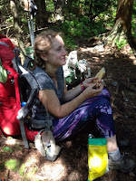
I had gotten word from the B&B I stayed in at Stowe, that I would pass by a great deli, Eidelweiss. So I picked up a pastrami special called the Montreal, a bag of salt and vinegar chips, 2 gatorades and 2 croissant pastries. They were met with enthusiasm and appreciation. Well worth the extra effort it to to carry it up 4 mi rough terrain. At least my pack was much lighter on the way down!


Soooooo hungry and glad to see Mom and what she brought!

Moose tracks for real!