Monday, June 29, 2015

Where ARE you?

A view of what's ahead from Mt. Mansfield....Camel's Hump,
the Adirondaks, and beyond.
Stairs in Green Mtn Inn. 
4.7 miles

I left Camille at the top of Mt Mansfield, to go to what was going to be a lonely last night at the Green Mountain Inn. The inn has got to be one of the most comfortable, historical places to stay in the area. It's old, well appointed and friendly to thru hikers. We learned after the fact, that if you are a member of the Green Mountain Club you get a substantial discount. Not a bad way to support the trail maintenance and get a respite from it! As it turned out, there is a toll road that comes down near Stowe, from the other side of Mansfield. Camille had gotten a ride down and to the inn before I got back. What a great surprise! We enjoyed a nice dinner at a mexican restaurant and the really fluffy beds, one more night. We headed back up the toll road in the morning and this is what we missed yesterday!


Today!
What a difference a day makes, yesterday....


Met thru hiker Gabriel and we hiked down the mountain together.

Sunday, June 28, 2015

Rain, Rain Rain, Rain, Rain, Rain is the New Normal

7.6 miles
   
Gathering water
It was really apparent that rain is an integral part of living in this part of Vermont. Although the locals are used to it, they did admit this is the most rain they have seen a quite a while. It was time to get back to the trail, or never finish it! We started up Mt Mansfield, where it crosses VT 108. While taking 2 days off to catch up on rest and evaluate every ounce being carried, what was necessary, what could be dispatched with and where to make adjustments to lighten her load, Camille decided to try another water purification system. The great thing about doing a trail like this is that in crossing paths with other thru hikers, it's easy to consider other ways of doing things that are tested and recommended. Instead of carrying 2-4 liters of water, which is close to 10 lbs, some backpackers opt for the Sawyer Squeeze and only carry about 1/2  a liter at a time. It's quicker, and can be done more often and is drinkable in minutes verses almost an hour with the Aqua Muir drops. It's only drawback is does not kill viruses which are not usually found in this part of the country. We stopped at Taft lLodge for a snack and to test out the new system. Worked great!
Attaching filter to top
Squeeze water thru filter
into a spare bottle

As was expected, the trail was wet, water running everywhere, mud and swamp patches to negotiate as best as possible. We were actually hiking up into the clouds
Transfer filter water to
water bladder. The bladder
goes in the bacpack and is
accessible thru a drinking
tube while hiking.
So much iridescence, it was like
walking over copper, gold and silver.
Taft Lodge is situated partially up Mt. Mansfield,
Vermont's tallest mountain.
Taft Lodge is off the ski trails and looks like it could
accommodate at least 20 overnight guests.


I could not keep the hood
back on my rain jacket, so
opted for, as Camille called
it, the "mouse" look, lol.
It's a beautiful and remote setting with reminders
everywhere of it's past transients.


We were told there are spectacular views from the top of Mansfield. The last 100 yards or so is a steep rock scramble. It was probably good we couldn't see much beyond that. The wind picked up, the clouds hung close. We had to settle for the medallion that marked we had made it.

Camille headed over and down the other side, while I made my way, a bit weepy, back down where we had come. My head told me she was prepared, technically skilled from her years of rock climbing, and has a great gut instinct, but still....... sniff.

I hiked down with 2 very nice young men, James and Scott. They had come up a spur trail, which was steeper and more rock slabs. I gave them a ride back to their car when we sloshed back down to the bottom.


Saturday, June 27, 2015

Zero Day

0 miles

What would you do after walking almost 70 miles up and down mountains, carrying close to 40 lbs on your back in 7 days?

Beer, burger and fries at The Blue Donkey in Stowe VT, of course!

We also did laundry, explored Stowe, alternated between hot tub, cold pool. Rested.

Friday, June 26, 2015

Bear Hollow to VT 108

10.8 miles

Top of White Face
This was a hard day. I was tired, terrain was very rough and my feet were still wet. They had been wet since Haystack a few days back. I stopped for a long rest on White Face Mountain and was bummed as I looked out over all the mountains I had to cross. I was going to meet Mom at VT 108 and we were going to head up Mansfield, so had been texting her with updates. My phone was a little over half charged, my battery block for recharging it was out. It took me a while to get going. Mom texted me around 12:30 to let me know she was on here way up to meet me. I made the Trail Magic raman on top of Madonna peak and it was so fricking good! It was a good 15 minute stop and cold. I had to put my down puffy (coat) on. 

Elephant Peak
Trail ziggurut, cooool!
Camille had texted me earlier and I could tell she was waning. It is hard to convey how grueling this part of the trail is. There are descriptions in the Green Mountain info, but without context, how do you know??? The paths are rocky, muddy, full of tree roots and rock scrambles. Very demanding. The views are beautiful and serene, but the path too them anything but!

I had gotten word from the B&B I stayed in at Stowe, that I would pass by a great deli, Eidelweiss. So I picked up a pastrami special called the Montreal, a bag of salt and vinegar chips, 2 gatorades and 2 croissant pastries. They were met with enthusiasm and appreciation. Well worth the extra effort it to to carry it up 4 mi rough terrain. At least my pack was much lighter on the way down!


Soooooo hungry and glad to see Mom and what she brought!

Moose tracks for real!


Thursday, June 25, 2015

Corliss to Bear Hollow

15 miles


Beautiful watching the world wake up!
Mom's hike down John Po15 miles


Lamoille River flood. 
I got an early start, 6:50 am and was more than half way (8 mi) by 11:30. The afternoon went slower. I ran into a dad and son thru hikers at Prospect Rock. They really wanted beta about what was ahead so I took a break to chat with them. Found the raman at the suspension bridge (Trail Magic, again!) so took a break there to put it in my pack. Had to stop again to take my shoes off to cross a flooded river, then stop to put them back on. After doing that, I realized that Leo, a hiker a few days back, said there was a detour to avoid the high water. It really was no big deal, came up to my calves for about 10 feet before I could rock hop again. 

Weeeel, this explains a lot.
Moose trax!
Trail shadows! My last hike in Green Mt...
I think! 
I saw this sign on my way to moving the car. That explains a lot. Those large piles of grape size doo doo, just maybe.....!

I knew this would probably be my last hike in the Green Mountains before leaving Camille and heading home. Lots of mixed emotions. I am so amazed at this daughter of mine! Excited for the adventures and challenges she will have. But also, can't help but be anxious for her safe return home!


Butterfly on Whiteface Mountain

Wednesday, June 24, 2015

Belvedere & Corliss are not Reindeer

15 miles

View from fire tower on Belvedere.

I cruised through the 15 miles and arrived at Corliss Cabin around 5:30. It was painted purple, cute! This was my first night alone. It was good to get in early. I fixed my beef stroganoff for dinner and headed to bed at 8:30. Nothing eventful and with a cabin that the door could be latched, I was comfortable.
Fire tower steps

Another view from fire tower.
Trail buddy.
Cabin interior at Corliss. My first night alone.

Beaver Pond


Devil's Gulch. Very rocky, lots of slabs.

What animal makes these???!
Each the size of a large grape.


John Post trail view near the top.

Tuesday, June 23, 2015

Rain Day on Tilltoson

3.2 + 9.3 mi

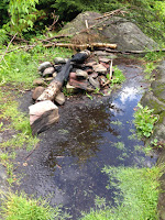
The fire pit the next morning.
It poured off and on all night. If anything, what was dry in the cabin absorbed the moisture in the air. The four guys were up and heading out before I was ready to leave. As we were getting ready to leave, Scout, a thru hiker arrived to let us know of storm warnings with hail were on the way, the worst being between noon and 3. We knew we may not make it out of the mountain areas and decided to wait till after 3. Scout left in what appeared to be a clearing around 2:45, and about 15 minutes later, the skies opened up with thunder and heavy rain. We stayed, snug in our bags, read and caught up on needed rest. It was a good layover.

We had a couple of guys bunk in our cabin that evening, Leo and Sean from Philly. They were thru hikers going north so gave us  good beta about the trail that was coming up. 
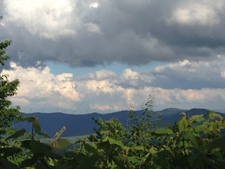
Sun in between downpours.

I was definitely happy to stay put, especially since Camille looked like she could use the rest, too!


Monday, June 22, 2015

Tillotson

11.9 miles

Breakfast in a bag.
I did laundry then hiked up John Post trail while Camille backpacked from Jay Camp to Tillotson. I would say that the trail markings could be better. I almost gave up finding the trail head up to Tillotson. The rain had caused streams to rise, and the parking lot at the trail head gave no indication which direction to go. A little Trail Magic in the form of a barking dog and lady coming out to get it, gave me a point in the right direction. I made it to Tillotson at about 5:30, to find 4 young men from Connecticut on a 4 day outing. So many interesting people, a diplomat, a police officer, a musician and a photographer. They made a fire, which seemed miraculous considering all the rain and moisture, but it was greatly appreciated. They were originally occupying the 4 bunks available, but some of us ended double bunking. Besides the champion snoring going on above Camille and I, it was cozy and comfortable.

Trail company
So I left Jay Camp about 9:15 am and backpacked across a series of 4 little peaks before cruising up to Haystack. It was a little challenging, rocky and a little wet. The day was getting away with me and it a little while longer because of mud and water. There was a trick log through a swampy area. Every other mud bog had these logs that go through it to. So I step on this log and I am up to my ankles in mud. At this point, it was, F it, and I walked right through swamp. My feet were so wet. Every time I stopped I wrung out my socks. I arrived to a campfire and mom. 


Stream bed or path? Both!
I was so relieved to see Camille! I had gone up the path to meet her but was stopped at the boggy area. Didn’t know how to get through it with out soaking feet. Fortunately, her text came through to let me know she was close. What a relief!